
Orienteering is an adventure sport where a person navigates around a set course with the aid of a map. Courses vary in length and difficulty and can be run in parks, woodland, open land and even streets. Each participant receives a map with a set course containing points which are to be visited in order. These points are found on orange and white “flags” and proof of visiting these is shown on the computer when finished. Each participant is given an individual SI card which is used to register the pupils at each control and gives an accurate time which can be viewed online after the event.
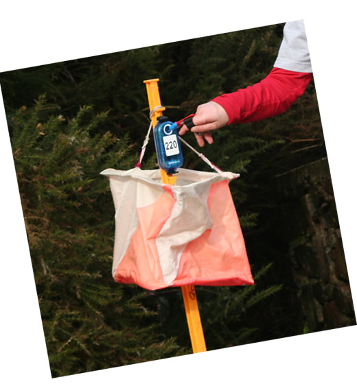
Example of the SI card system in action.
This is quite simple and easy for children to use. This sport is ideally suited to children of all ages and they certainly enjoy the whole experience.
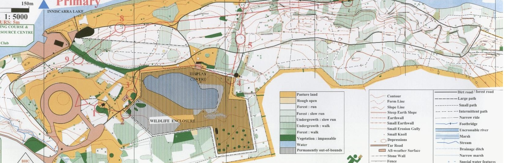
The Map
This is an example of a typical orienteering map used in the schools’ events. It shows the normal features of maps used and over written on the map are the points, in red, which have to be visited.The colours, contours, paths, roads, water features, fences, open land, runnable forest, impenetrable forest, man made features are all to be seen here. A full comprehensive explanation of map features will be explained clearly at the Introductory Events listed on the Fixtures page. These are easy for children to learn and all through the enjoyment of physical exercise. In more advanced orienteering a system of symbols is used. These are symbols used in the description sheets given at events which describe where the points are located. In schools events these symbols have an accompanying description in words, so as not to confuse newcomers and even old heads as well !!!!
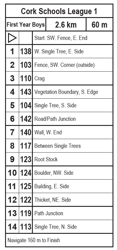
The control descriptions which are printed on every map give extra information on the course. In the example below the numbers 1 to 14 correspond to the red circles on the map also numbered 1 to 14. This is the order the controls must be found in. The numbers in the column to the right show the code that is printed onto each control, as seen in the picture above (Code 220). Each participant is encouraged to check the code on the map with the code on the control to ensure they have found the correct control. The text in the right hand column tells the participant what they are looking for, in the example below the 6th control has code 142 and is on the junction of a path and a road. The 10th control has code 124, it is located on the North West side of a boulder.
The Triangle on the map and descriptions indicates the Start. The finish is designated by two concentric circles on the map.
Taking part in these schools events couldn’t be simpler. Contact Liam O’ Brien at liamobrien001@hotmail.com and request to be put on the mailing list.
He will guide you through the whole process. Go on, and give it a try !!
You will receive notification emails of upcoming events.
Attend one of your local Introductory events then consider the League and Championship events.
Submit your entry list by the given date and show up on the day. At the event you will be given your groups SI cards and maps (maps for upper ages are given out at the start). Your pupils run/walk their course with the fastest time winning. Results will be available after the event on Orienteering.ie and this website. Hope we see you soon.
